 |
| A Big, Fat, Green Walnut |
This is a lovely walk that we did with family and friends, the children coped well and there was lots for them to do along the way. The route is approximately five and a half miles through fields, footpaths and bridleways.
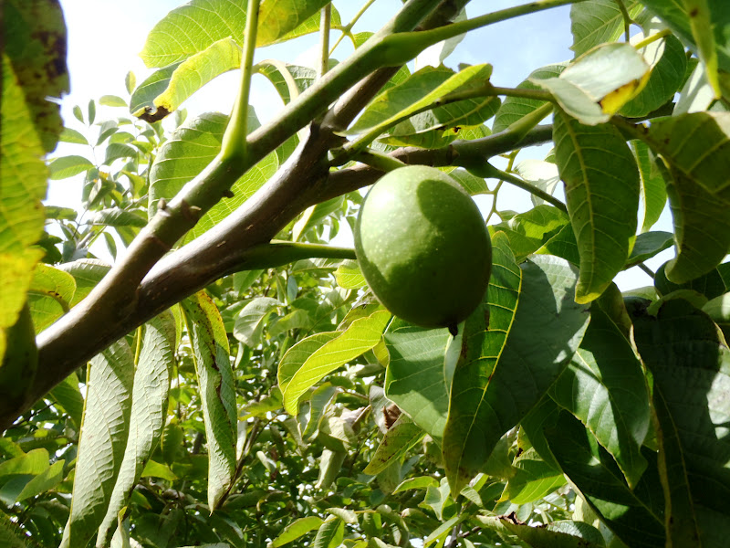
I planned this route chiefly because I was inquisitive about Walnut trees. On a previous adventure (last year), we found a proliferation of Walnuts on St. Catherine’s Hill and I had heard rumours of further trees along the Pilgrim’s Path, we were not disappointed.
We counted well over 20 Walnut trees over the course of our exploratory search! Some were small and many were massive. Lots of people seem fascinated by these versatile and healthy nuts, so now you'll be able to spot some.
 |
| A Tiny Hedgrow Walnut Tree |
We parked our car at the foot of Shawford Down (a great place for sledging in the snowy weather). You can get a train to Shawford station.
 |
| A Massive Mature Walnut |
We set off from near the Bridge Inn, the footpath heads North, up the Itchen Navigation Canal from Shawford.
 |
| Lovely Shawford Lock |
When you reach Shawford Lock, you can always stop to cool your feet (or even more of you) in the river. It is a most delightful spot and when I was a boy, my friends and I used to cycle here to go swimming during the long, hot summer holidays.
 |
| A Fat, Green Walnut - Almost Ripe |
We crossed a small wooden bridge and headed NE, over a field, on a footpath.
After crossing the Itchen River via a bridge, we headed up the road to Twyford village. We crossed the main road as we reached it and carried on up a track leading to a farm. Part of the way up this track we bared left onto a path that crossed it and headed North over Twyford Down. This is a bridleway that edges around Hockley golf course.
Along this path we collected and ate enough Blackberries to sustain an army of ramblers. There was even a danger that the children might not be hungry enough to eat the picnic. Eventually though, the route joins the Pilgrims Path at a crossroads. At this junction, we stopped for our picnic as it seemed about halfway.
 |
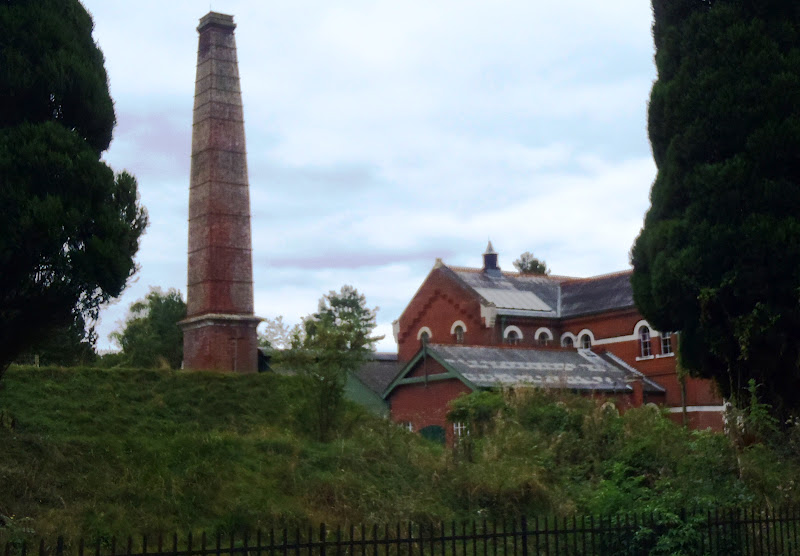
| Twyford Pumping Station |
We turned right and headed South, on the Pilgrim’s Path, all the way down to Hazeley Road. We then turned right and headed roughly West for a while along Hazeley Road. You pass, on your left, the Twyford Pumping Station, an imposing Victorian brick building with a large, square chimney left over from the days of steam power. This station has frequent open days and still supplies a lot of the local water from subterranean aquifers.
 |
| Evidence of an Indian Summer - Unseasonal Elderflowers |
Eventually we noticed a footpath way-marker, which indicated a diagonal route over a corn field, this was known as the Kingfisher’s Path. The corn had been harvested recently and there was lots of straw left in the field, so a hay fight was almost inevitable… The path continues past and even through some gardens and on into Twyford village, where we crossed the main road and headed down Church Lane (opposite).
 |
| Guess Who's Going To Look Like Wurzle Gummidge Shortly? |
Just before the river we found two large Sarsen stones on the left of the track. These were originally part of a circle of twelve standing stones; local lore has it that this ancient place of worship was built by a druidic tribe in the Pre-Roman era. The remains of the circle are now mostly buried beneath the foundations of Twyford’s Virgin Mary Church. These two sole survivors are all that remain visible now, by the roadside.
 |
| A Small Pagan, Possibly |
We then discovered a rope swing over the river Itchen and once we had managed to prise the children off it, we headed back across the fields to Shawford Lock.
 |
| Shawford Lock Open-Air Gym |
We sat by the lock for a while, to rest our weary soles and soak up the late summer atmosphere, before finally trotting back down the Itchen Navigation to Shawford. In Shawford village, if you deserve it, you can get a drink of ale or food at the Bridge Inn.
 I planned this route chiefly because I was inquisitive about Walnut trees. On a previous adventure (last year), we found a proliferation of Walnuts on St. Catherine’s Hill and I had heard rumours of further trees along the Pilgrim’s Path, we were not disappointed.


No comments:
Post a Comment